Lepton Software brings to you a high-quality and accurate rfMap-3D Geodata tool. It empowers the Telecom industry and leading network providers to enhance and deliver seamless as well as comprehensive high-speed 5G connection structure across locations.
5G network is the next best transformational move to meet the fastest growing demand for high-speed wireless connections.
What is 5G Network and how it works?
Millimetre Spectrum Waves | Operates on higher frequencies | Low response time | Faster speed by nearly 10 times | Best suited for densely populated areas | Massive device connectivity
But, with advantages come the challenges.
- It has less coverage span (300-500mtr.)
- Its frequency signals are easily hindered by line-of-sight issues
- It requires to set up thousands of cell sites/ transmitters
- It requires various intensive physical site surveys, adding costs & lead times
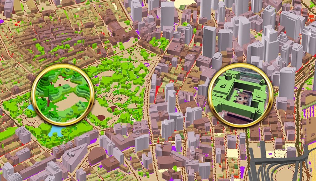
Above all, it needs a detailed and exclusive geospatial data set to overcome all these challenges. While it was easy and simple to plan 2G/3G/4G with minimum details and low-resolution 2D data, 5G planning is no similar. It effectively simulates your data into digital, high-resolution 3D representation by evaluating and analyzing geo-specific insights and topological observations by correlating datasets and elevation models. Leading you to envision a whole new perspective and outlook for your business.
Hence the solution, rfMap-3D Geodata from the house of Lepton Software.
Access exemplary digital-elevation data sets for 3D visualization, run simulations, and develop dynamic location-based experiences put together in rfMap-3D Geodata solution. Enabling mobile operators make swift and scrupulous decisions founded on the leading-edge advantages rfMap-3D Geodata offer. Such as minimizing revenue, delightful yet customized customer experience, location-driven predictions & solutions to strengthen and optimize network planning.
Also Read: 5G Network and Planning
Offerings & advantages of rfMap-3D Geodata
- Expertise: Extracts location-based high-definition 3D data sets of objects like trees, buildings, etc. solving line-of-sight issues.
- Precision: Reduces the number of physical site surveys, supports on-sight investigations, optimal placement & adjustment of network structure in a minimum time span.
- Value-added: Boost wireless broadband services, control & secure network investments, cost-effective, visibility of 5G sites for maximum benefits.
rfMap-3D Geodata Success Rate
Mapped: US, Asia, Middle East & Africa | Total Area: 33,600+ square kilometers
Why Lepton?
Global leader & pioneer in location analytics & intelligence solutions | 25+ years of experience | Serving 12+ industries | A team of 300+ data analysts, software engineers & digital cartographers.
Locate opportunities and gain a competitive edge to plan 5G Network with rfMap-3D Geodata.
Source:
*https://www.statista.com/chart/9604/5g-subscription-forecast/
** https://www.visualcapitalist.com/5g-next-generation-mobile-connectivity/
